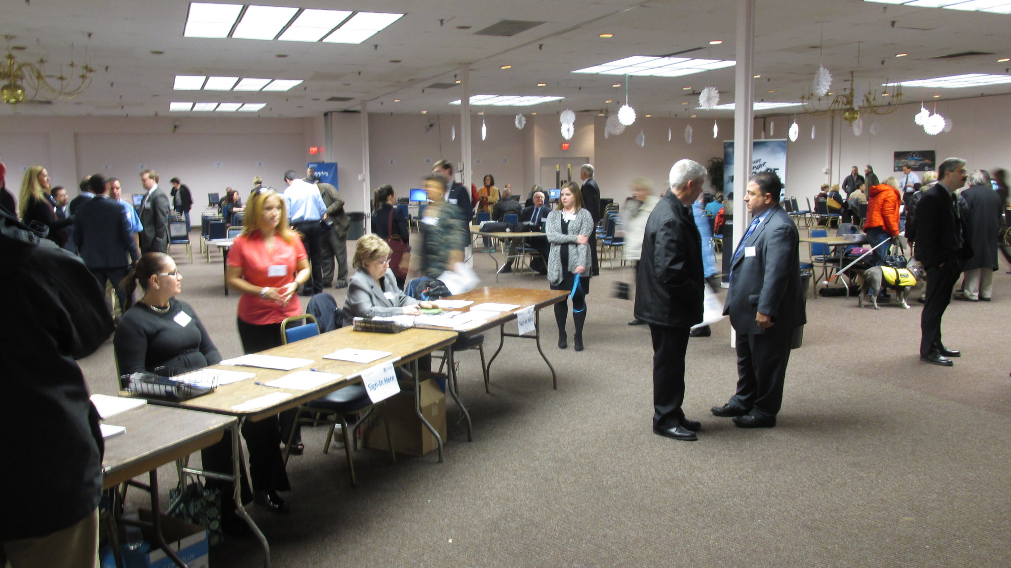
On Tuesday, Jan. 12, the Federal Emergency Management Agency held a well-attended Community Open House at the Boston Teachers Union Hall on Mt. Vernon Street. The primary purpose of the open house was to introduce Boston’s residents and landowners to FEMA’s updated “Flood Insurance Rate Maps.” Several hundred people attended, who kept coming and going throughout. The Open House was organized efficiently; the FEMA staff was well-informed and there was a pleasant buzz of interest.
A bit of history: For decades, the federal government has provided flood zone maps to the public. The original maps were developed on the ground, using transits and telescopes. They were very useful, but current-day satellite technology (LiDAR) has allowed far more accurate flood maps to be made.
In addition, there have been some recent flooding disasters caused by powerful hurricanes – disasters that were not accurately predicted. The two storms that hit the Gulf Coast – Ivan and Katrina – just over 10 years ago, followed by the Atlantic coast’s Hurricane Sandy in 2012, proved that U.S. flood maps urgently needed updating. FEMA was told, in essence, “to get its act together” to reduce future disaster risks.
FEMA became an authorized federal agency in 1979. In a government reorganization 13 years ago, FEMA was folded into the Department of Homeland Security and is now the government’s primary agency for responding to and recovering from natural disasters. It takes action after state governors ask for federal help, followed by the president formally issuing a “Federal Disaster Declaration.” FEMA will also follow up after a disaster, in an effort to prevent future problems. “Mitigation” is the key word describing FEMA’s mission.
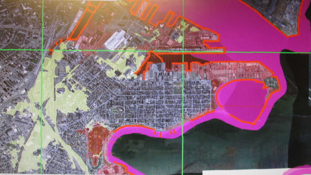
South Boston Online has included a newly issued FEMA flood map (see photo) of South Boston. This will give you an idea of how the new maps look. The shaded sections in the Boston Harbor waters indicate wave heights encountered during storms, including down to the ends of the Reserved and Fort Point Channels. Moakley Field is susceptible to flooding more than 1 percent of the time in any given year There’s also a lighter shading that indicates less frequent flooding potential, such as around Widett Circle and along train tracks.
But the good news is that most of South Boston is quite safe from flooding (see map photo). Much of the geography of South Boston is elevated, starting with Boston Street, which in colonial times was the only “dry” route onto our peninsula. And of course, Dorchester Heights is still the highest natural point in the entire city of Boston.
However, you must do your own legwork to determine your own property’s exact disaster risk (if any). First, check with your insurance agent. Then if you still have questions, contact the National Flood Insurance Program, which is administered by FEMA. You can do much of this online: msc.fema.gov and floodsmart.gov. Or contact FEMA in Region 1 directly at 99 High St., Sixth Floor, Boston 02110, or 877-336-2734.

